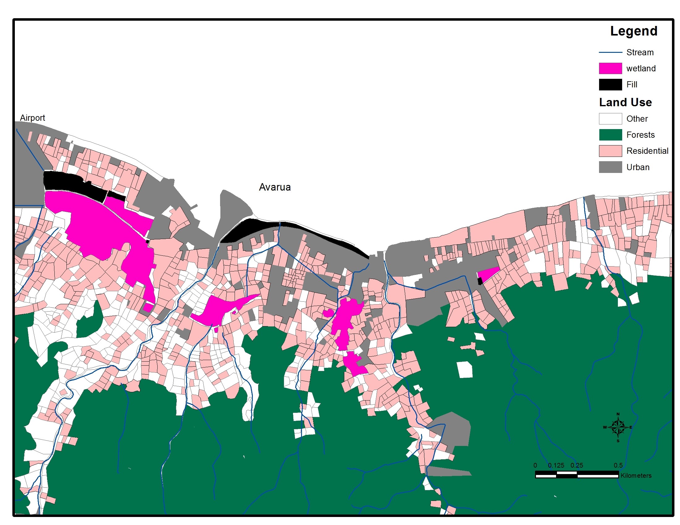
Rarotonga’s wetlands, with in-fill areas of…
The Cook Islands National Environment Service recognises the importance of the environment to the people of the Cook Islands. Our cultural identity is deeply rooted in our environment and it is a part of our heritage and legacy that must be passed on to future generations of Cook Islanders. As caretakers of the land, we must take pride in its natural beauty and it is critical to ensure that we work now to protect and conserve this precious resource. With careful nurturing, conservation and sound management we can achieve sustainable development while protecting our environmental, social and cultural heritage.
License
Maps
Data and Resource
| Field | Value |
|---|---|
| Publisher | Cook Islands National Environment Service |
| Modified | |
| Release Date | |
| Source URL | http://environment.gov.ck/ |
| Identifier | 28e6d183-4b88-4ff8-8716-48e9584082e2 |
| Spatial / Geographical Coverage Location | cook islands |
| Relevant Countries | Cook Islands |
| License |
SPREP Public Licence
![[Open Data]](https://assets.okfn.org/images/ok_buttons/od_80x15_blue.png)
|
| Contact Email | [email protected] |